Laser Scanning
N D Oliver & Co Ltd, Chartered Land Surveyors, are experts in the collection, organisation, presentation and delivery of spatial data. Over 80% of our work is repeat business. Our clients trust us to provide them with what they need.
With many successfully completed projects, we are a trusted provider of laser scanning surveys. Clients appreciate the benefit of having this work carried out by Chartered Land Surveyors. It allows you to:
» work with confidence
» reduce the risk of delays in your project
» understand and explain graphically to your clients and colleagues
Laser scanned surveys are used where data has to be collected quickly:
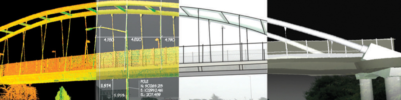
» a laser scanning survey collects large amounts of data very quickly » collect everything you see. Decide afterwards, at the computer, what you need to measure. You can think of it as measuring from coordinated 3D photos.
Laser scanned surveys are used where data has to be collected remotely:
» as the points are surveyed remotely you can survey areas that are inaccessible to personnel without the need to shut down plant or to gain permits for work
Laser scanned surveys are used where lots of data has to be collected: » uses include complicated structure modeling, heritage recording and monitoring surveys
We provide clients with Measurable Point Clouds and AutoCAD drawings. Clients often use these to produce 3D visualisations.
View samples of laser scanning surveys.
Contact us today to see how can help you.
